 orbitrace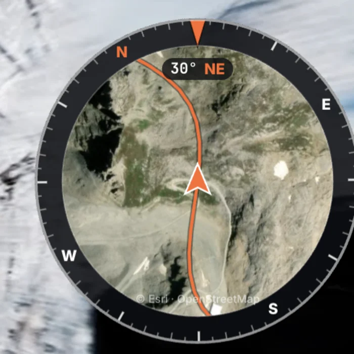
What a map adds to the story
- Orientation: the viewer knows which valley, which pass, which coast. Without it, a mountain road in the Alps looks like one in the Pyrenees.
- Progress: seeing the line grow from one episode to the next is a reason to watch the next one.
- Credibility: the distance and the climb stop being words. “We crossed three passes” becomes visible.
- Rhythm: a map is a natural transition between two days, two regions, two moods.
Three ways to use it
1. A mini-map in the corner, while riding
A small round or square map that follows your position, on the riding sequences. Keep it small and in a corner the image does not need (often bottom left or right, away from the road). This is what an overlay tool like Orbitrace does: the map is burned into the video and follows your GPS frame by frame. Add the location gauge, which shows the name of the street or town you are passing through: on a road trip, it often says more than the speed.
2. A full-screen map between stages
A few seconds of map between two days says “we moved on” better than a title card. Many vloggers build these in their editing software or with route-animation apps. Orbitrace does not animate multi-day routes; its library, which draws all your rides on one map, gives you a clean still image to use as a recap.
3. A recap at the end
Total distance, climb, highest point, number of days, and the whole route on screen. It is the shot people screenshot and share.
Street or satellite? North-up or heading-up?
| Choice | Best when |
|---|---|
| Street map | Towns, road networks, when the road name or junction matters |
| Satellite | Mountains, deserts, coastlines: the terrain itself tells the story |
| North-up | Recaps and transitions: viewers recognise the shape of the country |
| Heading-up (map turns with you) | While riding: left on screen is left on the road, the map reads like a GPS |
Which numbers to show (and which not)
- Good in a vlog: distance of the day, altitude at a pass, total climb, outside time of day.
- To think about twice: speed on open roads. It may not reflect well on you, and a figure above the limit on screen is evidence. On a track or a closed road, it is a different story.
- Lean angle on a motorcycle: a crowd favourite on mountain roads, as long as it stays reasonable.
Several days, several cameras
A road trip is hundreds of clips from a helmet camera, a car mount, a phone, sometimes a drone. Two habits help:
- Keep a GPS track running all day (watch, phone app, GPS remote) even if a camera has no GPS: you will attach the GPX to the clips that need it.
- Sort by day: Orbitrace’s library scans your SD cards, draws every clip on the map and lets you file them into folders (one per day or per country).
Protect your home
A map that starts at your door shows everyone where you live. Start the GPS recording a few kilometres away, or trim the beginning of the GPX before using it, and avoid putting the map on screen during the first and last minutes of the trip.
16:9 for YouTube, 9:16 for Shorts and Reels
The long episode goes to YouTube in 16:9; the best pass or the best sunset goes to Shorts and Reels in 9:16. In Orbitrace, the gauges stay where you placed them for each format, so the map is not hidden under the app’s buttons on a phone.