 orbitrace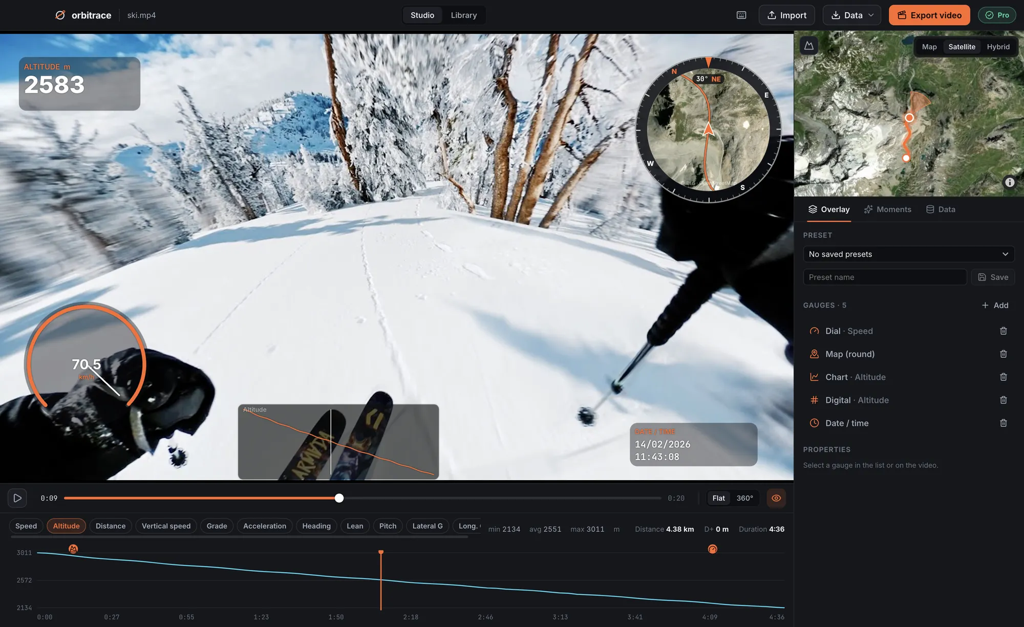
Which Insta360 cameras record GPS?
The Insta360 X3, X4 and X5 have no built-in GPS chip. The position is written into the .insv file from one of two sources:
- Your phone, connected to the camera through the Insta360 app while you record;
- An Insta360 GPS remote, on the models that support it.
The motion sensors (accelerometer and gyroscope) are always recorded, with or without GPS. That is what lets Orbitrace compute G-force, the artificial horizon and the lean angle even when there is no position data.
What Orbitrace reads from your .insv files
- GPS: position, speed, altitude and heading, shown on a real map (street or satellite);
- Motion sensors: G-force, attitude indicator, motorcycle lean angle;
- Highlights: top speed, biggest lean, jumps with their airtime, peak G — found automatically;
- Native 360° playback up to 8K, hardware-decoded, without converting your files first.
How to add speed to an Insta360 video
- Reframe in Insta360 Studio (free) and export your MP4 next to the original .insv — or skip this step and work on the 360° file.
- Open the .insv in Orbitrace. Telemetry is read in a few seconds and the track appears on the map.
- Pick your gauges — speed dial, map, altitude, compass, lean angle — and place them on your actual framing.
- Export. Orbitrace finds the reframed MP4 next to your .insv, burns the gauges in at source quality and keeps the original sound.
Getting a clean GPS track with an Insta360
Because the GPS comes from your phone or a remote, a few habits make a big difference:
- Turn GPS on in the Insta360 app settings before you start.
- Keep the Insta360 app in the foreground while recording and use its screen lock: if you switch apps, the phone may stop sending positions.
- Prefer normal video to timelapse if the track matters: with variable speed, the GPS cannot be matched precisely to each frame.
- Start once the phone has a fix, ideally under open sky.
Source: Mapillary’s Insta360 X series guide, which uses these cameras for street-level mapping.
No GPS in your file?
It happens: phone in airplane mode, app in the background, remote not paired. Two options:
- Attach a GPX recorded at the same time by a watch, a bike computer or a phone app (Strava, Komoot…). Orbitrace aligns it with the video time and lets you nudge it by the second or by the frame at export.
- Use the sensors only: G-force, horizon and highlights still work without GPS.